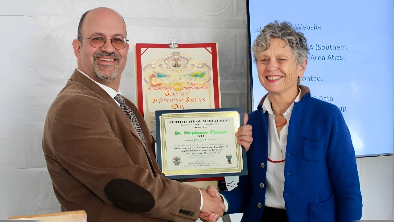
Transforming data into climate action: UCLA’s Stephanie Pincetl honored at LA County GIS Day
What if the key to solving climate change is hidden in the data we already have? Stephanie Pincetl believes the answer lies in connecting the dots.
What if the key to solving climate change is hidden in the data we already have? Stephanie Pincetl believes the answer lies in connecting the dots.
Her pioneering efforts were celebrated at Los Angeles County’s 17th Annual GIS Day, where hundreds of experts gathered to showcase innovative uses of geographic information systems (GIS) in sustainability and community development. Delivering the keynote address, Pincetl emphasized the power of data mapping. “Data by itself isn’t enough—we have to visualize it spatially to truly understand and act on it,” she said.
As the founding director of UCLA’s California Center for Sustainable Communities, Pincetl has transformed how GIS tools are used to tackle critical environmental challenges, from addressing urban planning inequities to reducing energy inefficiencies.
Central to her work is the UCLA Energy Atlas, an interactive platform that combines building energy data with sociodemographic and urban development insights. Covering Southern California and the San Francisco Bay Area, the Atlas reveals disparities in energy consumption and provides policymakers with the tools to address them.
“Older buildings, particularly in disadvantaged communities, often need retrofitting to improve energy efficiency and affordability,” Pincetl explained. The Energy Atlas identifies these gaps, guiding investments that align with California’s ambitious sustainability and equity goals.
Now the most comprehensive building energy database in the United States, the Atlas is a collaborative achievement that involved contributions from experts like Rob Graham—a GIS programmer and one of CCSC’s earliest team members. “It takes a team with diverse skills and shared vision to build something like the Energy Atlas,” Pincetl said.

Beyond the Energy Atlas, Pincetl and her team have broadened access to the Los Angeles Region Imagery Acquisition Consortium (LARIAC), which offers high-resolution aerial imagery and geospatial data for the county. Now available through the UCLA Library, Bruins can use the LARIAC for urban planning, environmental monitoring and public safety.
“It’s an amazing resource for anyone wanting to spatially analyze features like buildings, tree canopy cover and other landscape elements within LA County,” Pincetl noted.
At GIS Day, Steven Steinberg, LA County’s Geographic Information Officer, presented Pincetl with an award recognizing CCSC’s work on the Energy Atlas as a GIS tool. The event also featured dozens of specialized maps and apps created by local GIS professionals, from a story map that tracks the history of Los Angeles’s Indigenous landscape to a static map showcasing certified farmers’ markets across the county.
Reflecting on the award, Pincetl remarked, “I was very honored to see decades of work recognized as useful and valuable for the work public agencies do. Knowing there’s interest and support for this work means a lot—it’s validation that what we’ve done is making a difference.”
California’s pursuit of equity and sustainability often creates tensions between environmental goals and social justice, but tools like the Energy Atlas demonstrate how data can promote fairer and more climate-resilient outcomes. For Pincetl, transparency and collaboration are at the heart of this effort.
“Data transparency is the foundation of equity and sustainability,” she said. “It empowers public agencies to transform information into meaningful action.”
Published:


